A Master Plan has to be revised at least every ten years. Yet before a single line of the bill is written, four stages decide whether the future law will have any connection to the real city. There are five stages in total, and this post walks through each one following the methodology of Brazil’s Guide for Drafting and Revising Master Plans.
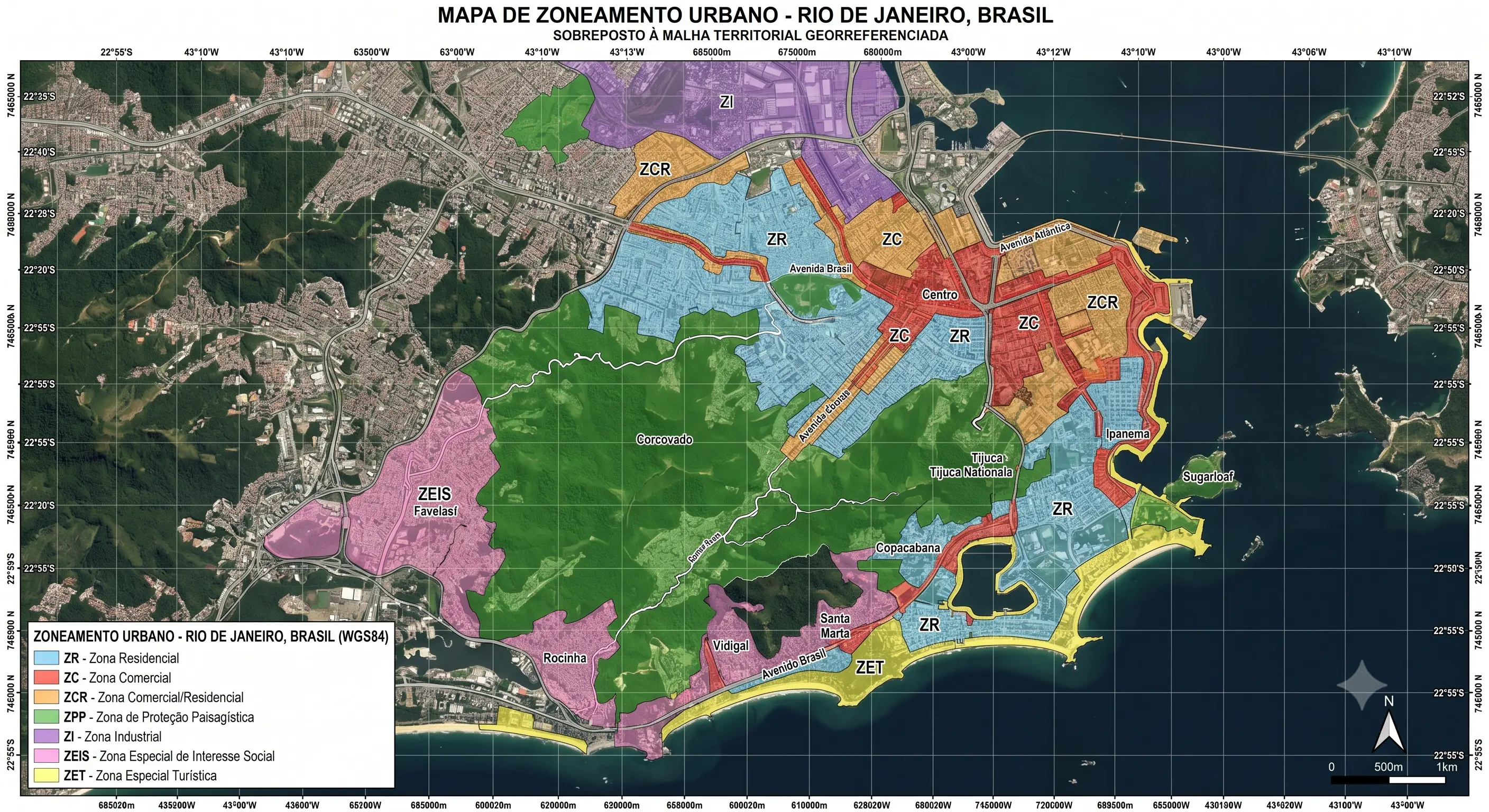
In Brazil, the Master Plan (Plano Diretor) is the municipal law that guides urban development and expansion policy. It organizes the territory, ensures that property fulfills its social and environmental function, and is the main mechanism for delivering the right to sustainable cities: housing, infrastructure, sanitation, and mobility. I have already written about why it relies directly on surveying and mapping; here the focus is the drafting process itself.
The plan does not end with itself. It unfolds into instruments that make it work day to day: Macrozoning and Zoning, Land Subdivision laws, inducement instruments such as Special Zones of Social Interest (ZEIS) and charged building rights, plus sector plans for mobility, sanitation, and housing. Each stage below sets the ground so those instruments are chosen with judgment.
Stage 1: build governance before the diagnosis
Before any diagnosis, you have to define who runs the process. The recommendation is to form a steering group led by the executive branch, in coordination with the legislature and civil society, bringing together technical teams from several departments (environment, housing, mobility) and community representatives, with diversity in gender, race, and age.
In parallel, you set a clear timeline covering every stage (meetings, workshops, public hearings) and widely publicize the communication channels. Events must happen at accessible times and in places easy to reach by public transport. Without this base, public participation becomes a formality, and the plan loses legitimacy from the outset.
Stage 2: read the territory to see the real city
Here the municipality identifies its features, challenges, and potential. You gather the basic and complementary surveys (land use, infrastructure, risk areas, population density, sanitation, and environmental networks), all georeferenced, because it is the map that lets you say where each problem actually happens.
The data-driven technical reading has to be cross-checked with a community reading: the lived experience of those who inhabit the city. From that exchange comes the first summary table, with the main issues listed and located by area of occurrence: urban, peri-urban, rural, or natural. It is the difference between planning the city on paper and the city that actually exists.
Stage 3: from the problem to the strategy
With problems mapped, you define how to tackle them. It begins with analyzing the structuring systems that connect the city: mobility, sanitation, green areas, public facilities, and centralities.
For each issue identified in the previous stage, a set of strategies is agreed upon with society, working as action guidelines. Only then do you select the planning instruments best suited to carry them out (ZEIS, charged building rights, Macrozoning), filling in the Proposals Summary Table. Order matters: an instrument without a clear strategy becomes a dead letter in the law.
Stage 4: consolidate the proposal into a bill
This is where the proposal takes legal shape. The steering group performs a cross-reading between the desired functions for the territory (Stage 2) and the proposed strategies and instruments (Stage 3), checking for contradictions and ensuring coherence.
Citing the legal instruments is not enough: the technical team must detail how each one will work, what will be regulated within the plan itself, and what will depend on specific future laws. It pays to prioritize what the municipality genuinely has the technical and operational capacity to implement. Then you structure the bill’s minimum content: principles and guidelines, territorial organization, inducement instruments, and the democratic management system.
Stage 5: approval, implementation, and monitoring
Consolidation ends the drafting, but not the cycle. The bill goes to the City Council, where it must be debated and voted on, and where social mobilization has to continue so the proposal is not watered down.
Once enacted, implementation follows: structuring governance, issuing regulatory decrees, and, above all, ensuring the plan’s actions and deadlines are reflected in the budget (the multi-year plan and budget guidelines law). Finally comes monitoring: indicators and targets tracked alongside management councils, feeding corrections and preparing the future revisions, which are mandatory at least every ten years.
What holds the five stages together
None of these stages stands without an up-to-date, georeferenced cartographic base. It is what locates problems during the reading of the territory, structures Macrozoning and Zoning, and brings transparency once the data is published in open formats. If you work with GIS, this is where engineering meets urban planning. That bridge is what I have been writing about here.
Want to talk through the cartographic base of a Master Plan, or how to spatialize the surveys? Reach out by email (eng.dcamargo@outlook.com.br) or WhatsApp.
Reference
MINISTÉRIO DO DESENVOLVIMENTO REGIONAL; MINISTÉRIO DO MEIO AMBIENTE. Guia para Elaboração e Revisão de Planos Diretores. [S.l.: s.n., 2022].