The Master Plan (in Brazil, Plano Diretor) is the basic law governing a municipality’s urban development and expansion policy, as established by the Federal Constitution. For anyone studying Advanced Surveying, it is the document that organizes the physical and territorial space and defines how the territory should be read, planned, and managed. More than a legal instrument, the Master Plan is the main consumer of a municipality’s georeferenced maps.
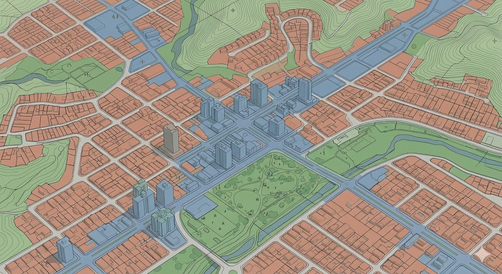
The link between the Master Plan and surveying is direct: land-use rules only make sense when grounded in an up-to-date cartographic base. In this article, we explain the technical nature of the Master Plan, which surveys it requires during the diagnostic phase, and how that data becomes zoning and urban planning parameters.
The Master Plan from a Surveying Perspective
The Master Plan is a municipal law that articulates the physical, economic, and social aspects desired by the community. Its purpose is to order the full development of the functions performed within the territory (work, housing, leisure, and circulation) based on a careful reading of the space.
For surveying, the Master Plan matters for three reasons:
- It defines territorial planning: it establishes how the municipal territory (urban and rural areas) should be organized and how property must fulfill its social function.
- It requires reading the territory: its creation starts from characterizing the municipality’s main problems, conflicts, and potential.
- It adopts georeferencing as a foundation: information is expected to be georeferenced and made available in open, accessible formats.
For a surveying specialist, the Master Plan is not just a law: it is the main client for mapping and geoprocessing work.
Essential Mapping in the Reading of the Territory
The “Reading of the Territory” is the stage where surveying work becomes central. The goal is to spatialize the municipality’s issues: to locate them in space so they can be mapped, cross-referenced, and analyzed.
The surveys of greatest interest to Advanced Surveying include:
- Regional mapping: carried out at scales that consider inter-municipal relationships, identifying regional road systems, urban centers, watersheds, and conservation units.
- Evolution of occupation: locates new patches of urban and rural occupation through comparative aerial photos, overlaying basins, springs, and Permanent Preservation Areas (PPAs) to reveal growth dynamics.
- Land use and occupation: maps population density, vacant lots, building heights, and predominant morphologies, cross-referencing this data with existing infrastructure.
- Infrastructure conditions: details the distribution of sanitation networks (water, sewage, and drainage), electricity, and public facilities, locating underserved areas.
- Environmental system and ecosystem services: positions the hydrographic network, basins and sub-basins, PPAs, legal reserves, and relevant vegetation cover, flagging conflicts for urban expansion.
- Climate risks: identifies heat islands, flood-prone areas, mass movements (landslides), and water scarcity, supporting adaptation and mitigation measures.
From Map to Rule: Macrozoning and Zoning
With the data collected, the Master Plan converts it into instruments for regulating the territory. This is where the map stops being a diagnosis and becomes a norm.
- Macrozoning: articulates urban, rural, and environmental strategies, establishing broad occupation areas (urban, peri-urban, rural, and natural). It guides the definition of the urban perimeter, which delimits where urban policy rules apply.
- Zoning: translates macrozoning into concrete parameters for each zone, such as Floor Area Ratio (FAR), occupancy rate, and building height. These parameters determine urban morphology and both built and population density.
- Territorial structuring systems: even though they are not mandatory under the City Statute, they organize structural themes such as mobility, environmental sanitation, green areas, public facilities, and centralities.
Final Thoughts
The Master Plan depends directly on an up-to-date, georeferenced cartographic base to function. It is this base that spatializes conflicts, reveals potential, and underpins land-use rules. For surveying professionals, understanding the Master Plan means seeing the ultimate destination of fieldwork: every survey, every map, and every layer overlay feeds the decisions that shape the city. Mastering this bridge between precise measurement and urban planning is what sets apart the technician who merely collects data from the one who helps organize the territory.
Bibliographic Reference:
- MINISTÉRIO DO DESENVOLVIMENTO REGIONAL; MINISTÉRIO DO MEIO AMBIENTE. Guia para Elaboração e Revisão de Planos Diretores. [S.l.: s.n.], 2022.